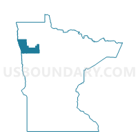
Fisher Voting District, Polk County, Minnesota
About
Outline

Summary
| Unique Area Identifier | 603726 |
| Name | Fisher Voting District |
| County | Polk County |
| State | Minnesota |
| Area (square miles) | 0.42 |
| Land Area (square miles) | 0.42 |
| Water Area (square miles) | 0.00 |
| % of Land Area | 100.00 |
| % of Water Area | 0.00 |
| Latitude of the Internal Point | 47.79919600 |
| Longtitude of the Internal Point | -96.79944870 |
Maps


Graphs
Select a template below for downloading or customizing gragh for Fisher Voting District, Polk County, Minnesota